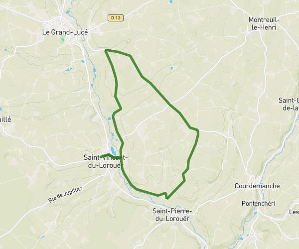
This running route covers 8.792mi starting from Saint-Vincent-du-Lorouër, Sarthe. The run is a loop trail and returns to the trailhead. This run is rated as hard, expect about 1h34m to complete it. The route has an elevation gain of 797ft and an elevation loss of 810ft.
14km
Route details
5.61mph
Speed
1075 kcal
Calories burned
Loop trail
Route type
230ft
Min altitude
459ft
Max altitude
Route profile
797ft
Elevation gain
810ft
Elevation loss
230ft
Min altitude
459ft
Max altitude
How to get there
Trailhead: 49 Route De Pruillé, 72150 Saint-Vincent-du-Lorouër, France
GPS coordinates of the trailhead: 47.824347, 0.486902 / 47°49'27'' N, 0°29'12'' E