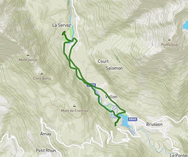
This cycling route covers 2.26mi starting from Brusson, Aosta Valley. The ride is a loop trail and returns to the trailhead. This route is rated as easy, plan for about 12m30s to complete it. The route has an elevation gain of 331ft and an elevation loss of 344ft.
Vollon e Brusson
Route details
113 kcal
Calories burned
5.7%
Avg grade
Loop trail
Route type
4196ft
Min altitude
4439ft
Max altitude
Steep climb
Route profile
331ft
Elevation gain
344ft
Elevation loss
4196ft
Min altitude
4439ft
Max altitude
How to get there
Trailhead: Chemin Les Crêtes 18, 11022 Brusson Aosta Valley, Italy
GPS coordinates of the trailhead: 45.75917, 7.71555 / 45°45'33'' N, 7°42'55'' E