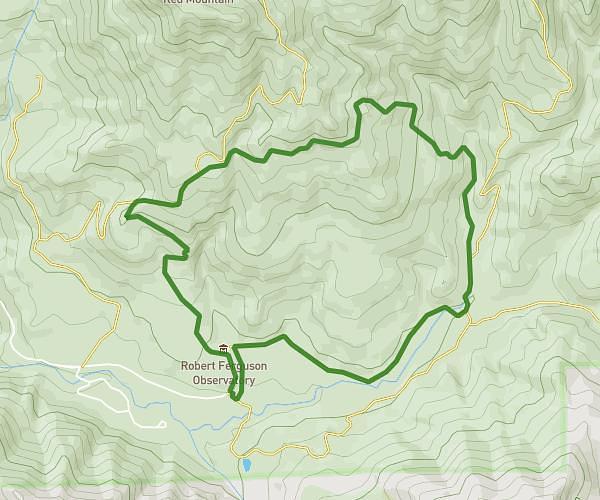
Explore this hiking route of 3,459mi starting from Kenwood, California. The hike is a loop and returns to the starting point. This hike has no defined difficulty level, plan for about 1h35m to complete it. The route has a positive elevation gain of 837ft and a negative elevation loss of 840ft.
Sugarloaf Vista Trail #1
Route details
Route profile
837ft
Elevation +
840ft
Elevation -
1237ft
Min altitude
1949ft
Max altitude
How to get there
Route starting point: Hillside Trail, 95452 Kenwood
GPS coordinates of the starting point: 38.43656, -122.50807 / 38°26'11'' N, 122°30'29'' W