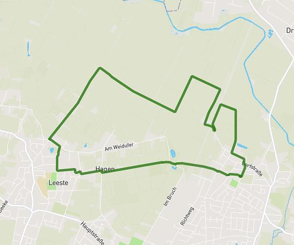
This running route covers 1.793mi starting from Ganderkesee, Lower Saxony. The run does not return to the trailhead and ends near Moorweg, 27777 Ganderkesee, Germany. This run is rated as easy, expect about 19m to complete it. The route has an elevation gain of 98ft and an elevation loss of 79ft.
für Abu u. Maja
Route details
5.66mph
Speed
217 kcal
Calories burned
Point to point
Route type
112ft
Min altitude
151ft
Max altitude
Route profile
98ft
Elevation gain
79ft
Elevation loss
112ft
Min altitude
151ft
Max altitude
How to get there
Trailhead: Donnermoor 75, 27777 Ganderkesee, Germany
GPS coordinates of the trailhead: 53.020379, 8.537584 / 53°1'13'' N, 8°32'15'' E