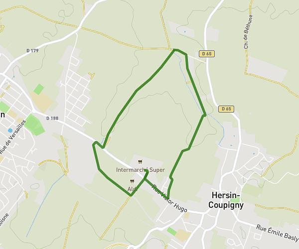
This running route covers 3.306mi starting from Agny, Pas-de-Calais. The run is a loop trail and returns to the trailhead. This run is rated as easy, expect about 35m28s to complete it. The route has an elevation gain of 184ft and an elevation loss of 187ft.
Course
Route details
5.59mph
Speed
406 kcal
Calories burned
Loop trail
Route type
200ft
Min altitude
259ft
Max altitude
Route profile
184ft
Elevation gain
187ft
Elevation loss
200ft
Min altitude
259ft
Max altitude
How to get there
Trailhead: 17 Rue Jean Jaurès, 62217 Agny, France
GPS coordinates of the trailhead: 50.258223, 2.759078 / 50°15'29'' N, 2°45'32'' E