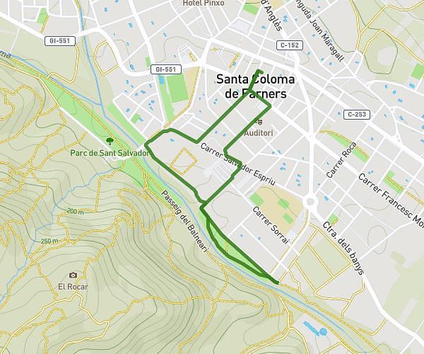
This walking route covers 2.023mi starting from Santa Coloma de Farners, Girona. The walk is a loop trail and returns to the trailhead. This walk is rated as easy, plan for about 43m to complete it. The route has an elevation gain of 197ft and an elevation loss of 197ft.
Tennis
Route details
21:16/mi
Pace
176 kcal
Calories burned
Loop trail
Route type
417ft
Min altitude
505ft
Max altitude
Route profile
197ft
Elevation gain
197ft
Elevation loss
417ft
Min altitude
505ft
Max altitude
How to get there
Trailhead: Carrer Sant Ignasi 1, 17430 Santa Coloma de Farners, Girona, Spain
GPS coordinates of the trailhead: 41.860792, 2.6662 / 41°51'38'' N, 2°39'58'' E