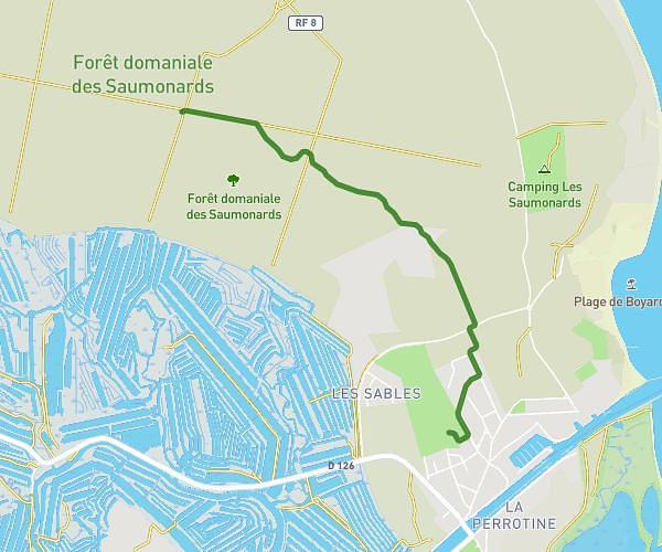
This running route covers 8.209mi starting from Thairé, Charente-Maritime. The run does not return to the trailhead and ends near 49 Boulevard De La Mer, 17340 Châtelaillon-Plage, France. This run is rated as hard, expect about 1h28m to complete it. The route has an elevation gain of 0ft and an elevation loss of 79ft.
Chatel
Route details
5.6mph
Speed
1006 kcal
Calories burned
Point to point
Route type
13ft
Min altitude
92ft
Max altitude
Route profile
0ft
Elevation gain
79ft
Elevation loss
13ft
Min altitude
92ft
Max altitude
How to get there
Trailhead: 10a Rue Du Château D'eau, 17290 Thairé, France
GPS coordinates of the trailhead: 46.082092, -0.967111 / 46°4'55'' N, 0°58'1'' W