MapPlanner
3.257mi
Distance
1h
Duration
3.26mph
Speed
+108ft
Elevation gain
-115ft
Elevation loss
Easy
Level

Dr jean Flow velo

Route details

529 kcal
Calories burned
1.3%
Avg grade
Loop trail
Route type
7ft
Min altitude
56ft
Max altitude

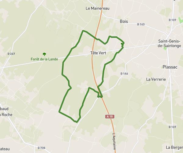
This cycling route covers 3.257mi starting from Rouffiac, Charente-Maritime. The ride is a loop trail and returns to the trailhead. This route is rated as easy, plan for about 1h to complete it. The route has an elevation gain of 108ft and an elevation loss of 115ft.

Route profile

108ft
Elevation gain
115ft
Elevation loss
7ft
Min altitude
56ft
Max altitude

How to get there

Trailhead: Le Ponton, 17800 Rouffiac

GPS coordinates of the trailhead: 45.6936, -0.49542 / 45°41'36'' N, 0°29'43'' W

Caution: May Cross Private Property

This route may pass through or near private property. Always respect posted signs, obtain permission where required, and follow local trespassing laws. MapPlanner does not guarantee public access along any route.

Safety Notice

Trail and road conditions may change without notice due to weather, construction, or other factors. Always verify current conditions before heading out. You are responsible for your own safety — follow local signage, obey traffic laws, and use your best judgment on the trail.