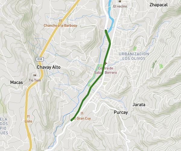
This running route covers 3.191mi starting from Azogues, Cañar. The run does not return to the trailhead and ends near Avenida 16 De Abril, Azogues - Cañar, 0301, Ecuador. This run is rated as easy, expect about 34m14s to complete it. The route has an elevation gain of 230ft and an elevation loss of 62ft.
ARUTAM
Route details
5.59mph
Speed
391 kcal
Calories burned
Point to point
Route type
7894ft
Min altitude
8091ft
Max altitude
Route profile
230ft
Elevation gain
62ft
Elevation loss
7894ft
Min altitude
8091ft
Max altitude
How to get there
Trailhead: Avenida 16 De Abríl, Azogues - Cañar, 0301, Ecuador
GPS coordinates of the trailhead: -2.781927, -78.855006 / 2°46'54'' S, 78°51'18'' W