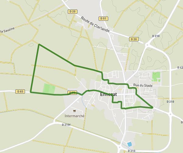
This walking route covers 4.003mi starting from Vichy, Allier. The walk is a loop trail and returns to the trailhead. This walk is rated as moderate, plan for about 1h26m to complete it. The route has an elevation gain of 125ft and an elevation loss of 125ft.
6KM
Route details
21:27/mi
Pace
351 kcal
Calories burned
Loop trail
Route type
814ft
Min altitude
837ft
Max altitude
Route profile
125ft
Elevation gain
125ft
Elevation loss
814ft
Min altitude
837ft
Max altitude
How to get there
Trailhead: 16 Quai D'allier, 03200 Vichy, France
GPS coordinates of the trailhead: 46.12811, 3.41574 / 46°7'41'' N, 3°24'56'' E