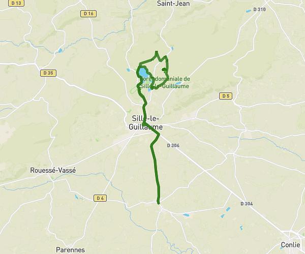
This cycling route covers 14.406mi starting from Rouez, Sarthe. The ride is a loop trail and returns to the trailhead. This route is rated as moderate, plan for about 1h16m to complete it. The route has an elevation gain of 476ft and an elevation loss of 417ft.
Le parcours mi route -mi chemin
Route details
673 kcal
Calories burned
1.2%
Avg grade
Loop trail
Route type
341ft
Min altitude
797ft
Max altitude
Route profile
476ft
Elevation gain
417ft
Elevation loss
341ft
Min altitude
797ft
Max altitude
How to get there
Trailhead: 10 Rue Andrée Le Grou, 72140 Rouez, France
GPS coordinates of the trailhead: 48.14257, -0.11755 / 48°8'33'' N, 0°7'3'' W