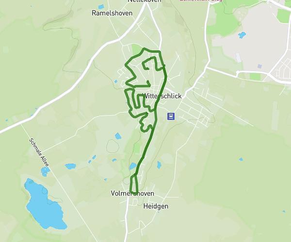
This running route covers 1.895mi starting from Köln, North Rhine-Westphalia. The run is a loop trail and returns to the trailhead. This run is rated as easy, expect about 20m to complete it. The route has an elevation gain of 3ft and an elevation loss of 7ft.
3km Kreis doppelt
Route details
5.69mph
Speed
229 kcal
Calories burned
Loop trail
Route type
184ft
Min altitude
187ft
Max altitude
Route profile
3ft
Elevation gain
7ft
Elevation loss
184ft
Min altitude
187ft
Max altitude
How to get there
Trailhead: Militärringstraße, 50997 Köln, Germany
GPS coordinates of the trailhead: 50.89176, 6.958197 / 50°53'30'' N, 6°57'29'' E