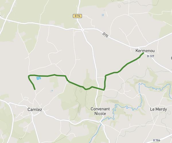
This running route covers 3.114mi starting from Trédrez-Locquémeau, Côtes-d'Armor. The run is a loop trail and returns to the trailhead. This run is rated as easy, expect about 30m to complete it. The route has an elevation gain of 312ft and an elevation loss of 312ft.
Boucle 1 Locquémeau
Route details
6.23mph
Speed
343 kcal
Calories burned
Loop trail
Route type
3ft
Min altitude
141ft
Max altitude
Route profile
312ft
Elevation gain
312ft
Elevation loss
3ft
Min altitude
141ft
Max altitude
How to get there
Trailhead: Hent Keravilin, 22300 Trédrez-Locquémeau
GPS coordinates of the trailhead: 48.72216, -3.56774 / 48°43'19'' N, 3°34'3'' W