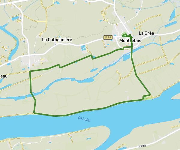
This running route covers 9.406mi starting from Ancenis-Saint-Géréon, Loire-Atlantique. The run is a loop trail and returns to the trailhead. This run is rated as hard, expect about 1h40m to complete it. The route has an elevation gain of 427ft and an elevation loss of 427ft.
Le 15 KM
Route details
5.59mph
Speed
1154 kcal
Calories burned
Loop trail
Route type
26ft
Min altitude
121ft
Max altitude
Route profile
427ft
Elevation gain
427ft
Elevation loss
26ft
Min altitude
121ft
Max altitude
How to get there
Trailhead: 189 Le Bois Robin, 44150 Ancenis-Saint-Géréon, France
GPS coordinates of the trailhead: 47.37657, -1.210265 / 47°22'35'' N, 1°12'36'' W