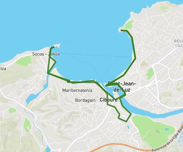
This running route covers 2.52mi starting from Saint-Jean-de-Luz, Pyrénées-Atlantiques. The run does not return to the trailhead and ends near Acotz, Saint-Jean-de-Luz, Pyrénées-Atlantiques, France. This run is rated as easy, expect about 1h to complete it. The route has an elevation gain of 125ft and an elevation loss of 30ft.
Corniche
Route details
2.52mph
Speed
686 kcal
Calories burned
Point to point
Route type
7ft
Min altitude
105ft
Max altitude
Route profile
125ft
Elevation gain
30ft
Elevation loss
7ft
Min altitude
105ft
Max altitude
How to get there
Trailhead: 6b Avenue Pierre Larramendy, 64500 Saint-Jean-de-Luz, France
GPS coordinates of the trailhead: 43.38394, -1.66178 / 43°23'2'' N, 1°39'42'' W