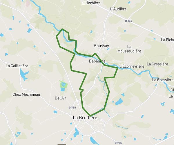
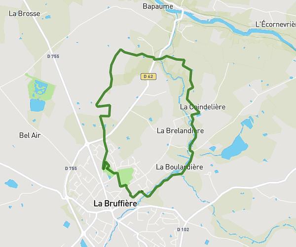
This hiking trail covers 6.951mi starting from Maisdon-sur-Sèvre, Loire-Atlantique. The hike is a loop trail and returns to the trailhead. This hike is rated as moderate, plan for about 42m to complete it. The route has an elevation gain of 495ft and an elevation loss of 492ft.
11 km rando Caffino 2026
Route details
9.93mph
Speed
301 kcal
Calories burned
2.7%
Avg grade
Loop trail
Route type
13ft
Min altitude
200ft
Max altitude
Route profile
495ft
Elevation gain
492ft
Elevation loss
13ft
Min altitude
200ft
Max altitude
How to get there
Trailhead: 8 Route De Caffino, 44690 Maisdon-sur-Sèvre, France
GPS coordinates of the trailhead: 47.124397, -1.415853 / 47°7'27'' N, 1°24'57'' W