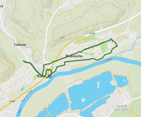
This running route covers 2.258mi starting from Longueil-Sainte-Marie, Oise. The run is a loop trail and returns to the trailhead. This run is rated as easy, expect about 24m to complete it. The route has an elevation gain of 23ft and an elevation loss of 26ft.
Début
Route details
5.64mph
Speed
274 kcal
Calories burned
Loop trail
Route type
135ft
Min altitude
161ft
Max altitude
Route profile
23ft
Elevation gain
26ft
Elevation loss
135ft
Min altitude
161ft
Max altitude
How to get there
Trailhead: 12a Impasse Du Moulin, 60126 Longueil-Sainte-Marie, France
GPS coordinates of the trailhead: 49.353965, 2.712224 / 49°21'14'' N, 2°42'44'' E