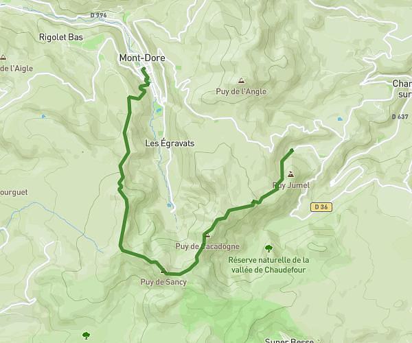
This hiking trail covers 4.535mi starting from Mont-Dore, Puy-de-Dôme. The hike is a loop trail and returns to the trailhead. This hike is rated as hard, plan for about 2h57m to complete it. The route has an elevation gain of 974ft and an elevation loss of 974ft.
Salon du Capucin
Route details
1.53mph
Speed
1323 kcal
Calories burned
8.1%
Avg grade
Loop trail
Route type
3451ft
Min altitude
4183ft
Max altitude
Steep climb
Route profile
974ft
Elevation gain
974ft
Elevation loss
3451ft
Min altitude
4183ft
Max altitude
How to get there
Trailhead: Route Perreire, 63240 Mont-Dore, France
GPS coordinates of the trailhead: 45.56925, 2.80227 / 45°34'9'' N, 2°48'8'' E