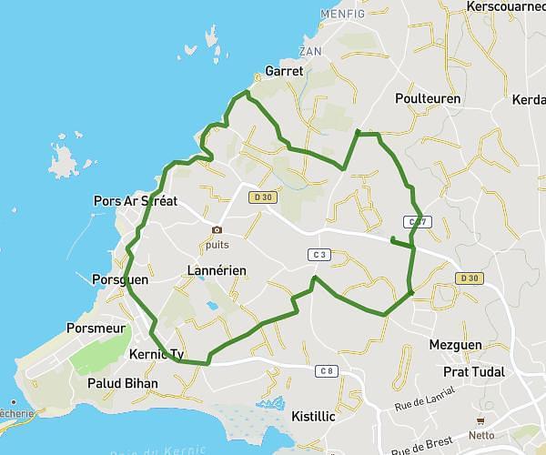
This running route covers 3.603mi starting from Ploudaniel, Finistère. The run does not return to the trailhead and ends near 76 Pen Bouillen, 29800 Saint-Thonan, France. This run is rated as easy, expect about 33m25s to complete it. The route has an elevation gain of 262ft and an elevation loss of 312ft.
Pen B 09 avril 26
Route details
6.47mph
Speed
382 kcal
Calories burned
Point to point
Route type
223ft
Min altitude
394ft
Max altitude
Route profile
262ft
Elevation gain
312ft
Elevation loss
223ft
Min altitude
394ft
Max altitude
How to get there
Trailhead: Chemin De Lor Ar Bruc, 29260 Ploudaniel, France
GPS coordinates of the trailhead: 48.475546, -4.300795 / 48°28'31'' N, 4°18'2'' W