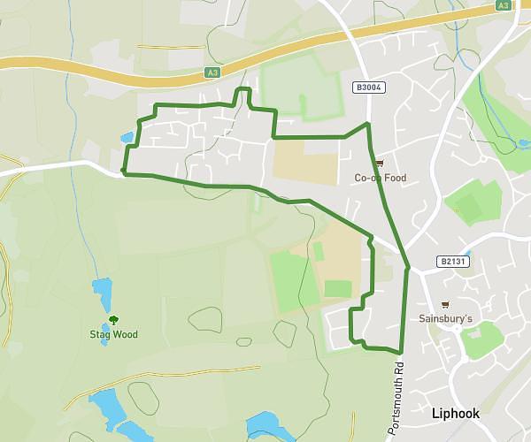
This running route covers 7.712mi starting from Liphook, England. The run is a loop trail and returns to the trailhead. This run is rated as hard, expect about 1h23m to complete it. The route has an elevation gain of 597ft and an elevation loss of 597ft.
Woolmer Ranges Loop
Route details
5.57mph
Speed
949 kcal
Calories burned
Loop trail
Route type
259ft
Min altitude
371ft
Max altitude
Route profile
597ft
Elevation gain
597ft
Elevation loss
259ft
Min altitude
371ft
Max altitude
How to get there
Trailhead: Griggs Green, Liphook, GU30 7PD, United Kingdom
GPS coordinates of the trailhead: 51.079808, -0.826277 / 51°4'47'' N, 0°49'34'' W