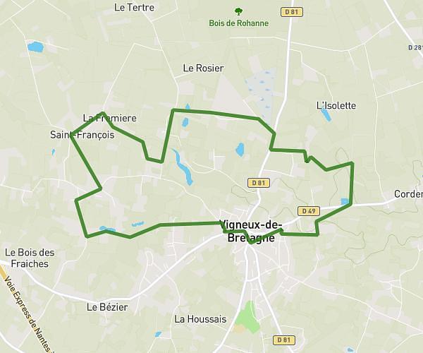
This running route covers 6.148mi starting from Grandchamp-des-Fontaines, Loire-Atlantique. The run is a loop trail and returns to the trailhead. This run is rated as moderate, expect about 1h5m to complete it. The route has an elevation gain of 354ft and an elevation loss of 358ft.
10km GDF
Route details
5.67mph
Speed
743 kcal
Calories burned
Loop trail
Route type
79ft
Min altitude
200ft
Max altitude
Route profile
354ft
Elevation gain
358ft
Elevation loss
79ft
Min altitude
200ft
Max altitude
How to get there
Trailhead: 4 Passage Julien Vincent, 44119 Grandchamp-des-Fontaines, France
GPS coordinates of the trailhead: 47.369402, -1.606858 / 47°22'9'' N, 1°36'24'' W