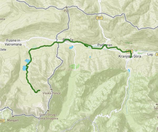
This running route covers 15.954mi starting from . The run does not return to the trailhead and ends near . This run is rated as strenuous, expect about 5h8m to complete it. The route has an elevation gain of 2615ft and an elevation loss of 2480ft.
LOG POD MANGARTOM-TARVISIO
Route details
3.11mph
Speed
3523 kcal
Calories burned
Point to point
Route type
2178ft
Min altitude
4767ft
Max altitude
Route profile
2615ft
Elevation gain
2480ft
Elevation loss
2178ft
Min altitude
4767ft
Max altitude
How to get there
Trailhead:
GPS coordinates of the trailhead: 46.40492, 13.59655 / 46°24'17'' N, 13°35'47'' E