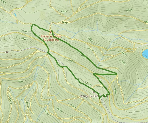
This hiking trail covers 5.459mi starting from Metzeral, Haut-Rhin. The hike does not return to the trailhead and ends near 180 Rue Du Hilsenfirst, 68610 Linthal, France. This hike is rated as strenuous, plan for about 2h55m to complete it. The route has an elevation gain of 2162ft and an elevation loss of 1102ft.
Randovosges 2026 Etape3 variante
Route details
1.86mph
Speed
1384 kcal
Calories burned
11.3%
Avg grade
Point to point
Route type
1565ft
Min altitude
3635ft
Max altitude
Steep climb
Route profile
2162ft
Elevation gain
1102ft
Elevation loss
1565ft
Min altitude
3635ft
Max altitude
How to get there
Trailhead: 87 Rue De La Gare, 68380 Metzeral, France
GPS coordinates of the trailhead: 48.013052, 7.072914 / 48°0'46'' N, 7°4'22'' E