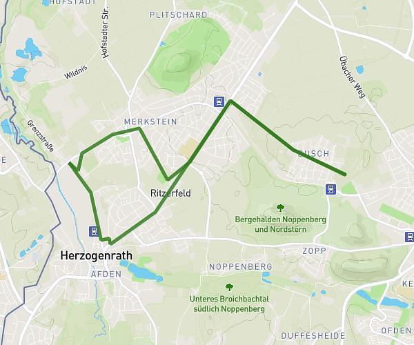
This running route covers 6.958mi starting from Würselen, North Rhine-Westphalia. The run is a loop trail and returns to the trailhead. This run is rated as moderate, expect about 1h23m to complete it. The route has an elevation gain of 463ft and an elevation loss of 459ft.
Bberg - alte Mühle - Teuter Hof Runde - Gouley - Bberg
Route details
4.97mph
Speed
960 kcal
Calories burned
Loop trail
Route type
364ft
Min altitude
597ft
Max altitude
Route profile
463ft
Elevation gain
459ft
Elevation loss
364ft
Min altitude
597ft
Max altitude
How to get there
Trailhead: Schönbrunner Straße 12, 52146 Würselen, Germany
GPS coordinates of the trailhead: 50.841622, 6.112376 / 50°50'29'' N, 6°6'44'' E