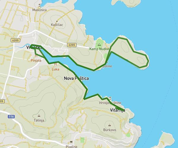
This running route covers 7.739mi starting from Jelsa, Split-Dalmatia. The run does not return to the trailhead and ends near Uvala Maslinica 2, 21460 Selca kod Starog Grada, Croatia. This run is rated as hard, expect about 1h23m to complete it. The route has an elevation gain of 614ft and an elevation loss of 676ft.
Trajekt
Route details
5.59mph
Speed
949 kcal
Calories burned
Point to point
Route type
-10ft
Min altitude
89ft
Max altitude
Route profile
614ft
Elevation gain
676ft
Elevation loss
-10ft
Min altitude
89ft
Max altitude
How to get there
Trailhead: Šetalište Jelšanskih Pomoraca 41, 21465 Jelsa, Croatia
GPS coordinates of the trailhead: 43.170775, 16.691048 / 43°10'14'' N, 16°41'27'' E