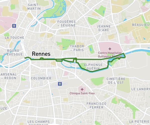
This running route covers 3.831mi starting from Rennes, Ille-et-Vilaine. The run is a loop trail and returns to the trailhead. This run is rated as easy, expect about 41m to complete it. The route has an elevation gain of 207ft and an elevation loss of 207ft.
RUN MIX BRUNCH V4
Route details
5.6mph
Speed
469 kcal
Calories burned
Loop trail
Route type
72ft
Min altitude
98ft
Max altitude
Route profile
207ft
Elevation gain
207ft
Elevation loss
72ft
Min altitude
98ft
Max altitude
How to get there
Trailhead: 2 Quai Saint-Cyr, 35000 Rennes, France
GPS coordinates of the trailhead: 48.10982, -1.686011 / 48°6'35'' N, 1°41'9'' W