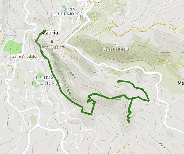
This running route covers 6.77mi starting from Lauria, Potenza. The run does not return to the trailhead and ends near Vico Primo Palestro 26, 85044 Lauria Potenza, Italy. This run is rated as moderate, expect about 3h25m to complete it. The route has an elevation gain of 1214ft and an elevation loss of 1332ft.
Ferrovia
Route details
1.98mph
Speed
2344 kcal
Calories burned
Point to point
Route type
1040ft
Min altitude
2372ft
Max altitude
Route profile
1214ft
Elevation gain
1332ft
Elevation loss
1040ft
Min altitude
2372ft
Max altitude
How to get there
Trailhead: Corso Cairoli, 85044 Lauria Potenza, Italy
GPS coordinates of the trailhead: 40.04348, 15.83728 / 40°2'36'' N, 15°50'14'' E