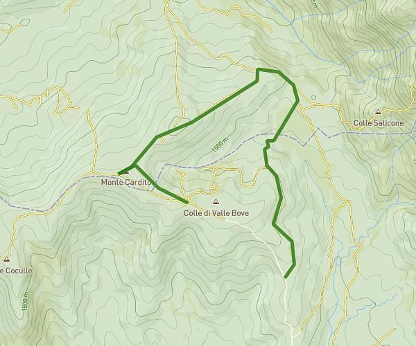
This hiking trail covers 2.927mi starting from Campotosto, L'Aquila. The hike does not return to the trailhead and ends near 67013, Campotosto, L'Aquila, Italy. This hike is rated as moderate, plan for about 1h34m to complete it. The route has an elevation gain of 446ft and an elevation loss of 755ft.
Monte cardito LH
Route details
1.86mph
Speed
691 kcal
Calories burned
7.8%
Avg grade
Point to point
Route type
4744ft
Min altitude
5269ft
Max altitude
Route profile
446ft
Elevation gain
755ft
Elevation loss
4744ft
Min altitude
5269ft
Max altitude
How to get there
Trailhead: 67013, Campotosto, L'Aquila, Italy
GPS coordinates of the trailhead: 42.575614, 13.358125 / 42°34'32'' N, 13°21'29'' E