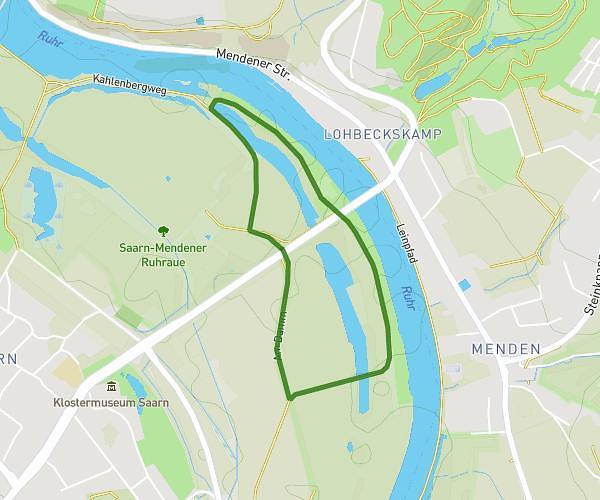
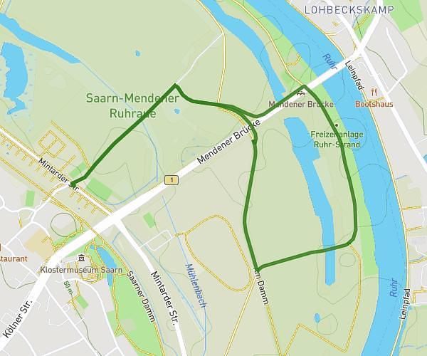
This walking route covers 1.892mi starting from Mülheim an der Ruhr, North Rhine-Westphalia. The walk is a loop trail and returns to the trailhead. This walk is rated as easy, plan for about 45m40s to complete it. The route has an elevation gain of 151ft and an elevation loss of 151ft.
Saarn Mendener Ruhrauen-Weg
Route details
24:08/mi
Pace
186 kcal
Calories burned
Loop trail
Route type
112ft
Min altitude
144ft
Max altitude
Route profile
151ft
Elevation gain
151ft
Elevation loss
112ft
Min altitude
144ft
Max altitude
How to get there
Trailhead: Mintarder Straße, 45481 Mülheim an der Ruhr, Germany
GPS coordinates of the trailhead: 51.405284, 6.881155 / 51°24'19'' N, 6°52'52'' E