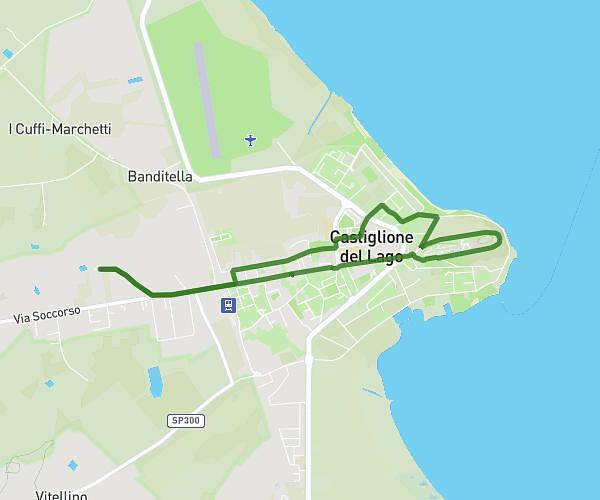
This running route covers 4.659mi starting from Castiglione del Lago, Perugia. The run is a loop trail and returns to the trailhead. This run is rated as easy, expect about 41m11s to complete it. The route has an elevation gain of 157ft and an elevation loss of 157ft.
giro del lungo lago
Route details
6.79mph
Speed
471 kcal
Calories burned
Loop trail
Route type
830ft
Min altitude
883ft
Max altitude
Route profile
157ft
Elevation gain
157ft
Elevation loss
830ft
Min altitude
883ft
Max altitude
How to get there
Trailhead: Via Dei Tulipani, 06061 Castiglione del Lago Perugia, Italy
GPS coordinates of the trailhead: 43.12564, 12.02048 / 43°7'32'' N, 12°1'13'' E