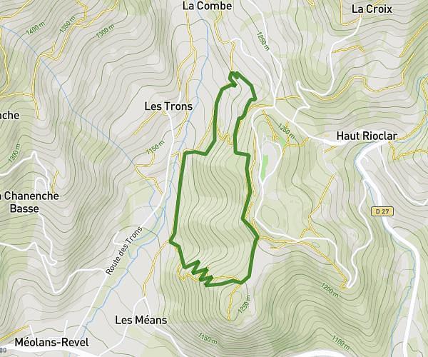
This walking route covers 4.007mi starting from Montclar, Alpes-de-Haute-Provence. The walk does not return to the trailhead and ends near 8 Chemin Haut De Costebelle, 04340 Ubaye-Serre-Ponçon, France. This walk is rated as moderate, plan for about 1h30m to complete it. The route has an elevation gain of 502ft and an elevation loss of 1198ft.
Montclar Costebelle
Route details
22:27/mi
Pace
368 kcal
Calories burned
Point to point
Route type
3497ft
Min altitude
4577ft
Max altitude
Route profile
502ft
Elevation gain
1198ft
Elevation loss
3497ft
Min altitude
4577ft
Max altitude
How to get there
Trailhead: D 900, 04140 Montclar, France
GPS coordinates of the trailhead: 44.41551, 6.35117 / 44°24'55'' N, 6°21'4'' E