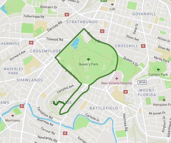
This walking route covers 3.275mi starting from Glasgow, Scotland. The walk is a loop trail and returns to the trailhead. This walk is rated as moderate, plan for about 55m to complete it. The route has an elevation gain of 233ft and an elevation loss of 236ft.
Merrylee
Route details
16:48/mi
Pace
225 kcal
Calories burned
Loop trail
Route type
82ft
Min altitude
194ft
Max altitude
Route profile
233ft
Elevation gain
236ft
Elevation loss
82ft
Min altitude
194ft
Max altitude
How to get there
Trailhead: 92 Mansionhouse Gardens, Glasgow, G41 3DP, United Kingdom
GPS coordinates of the trailhead: 55.825304, -4.279027 / 55°49'31'' N, 4°16'44'' W