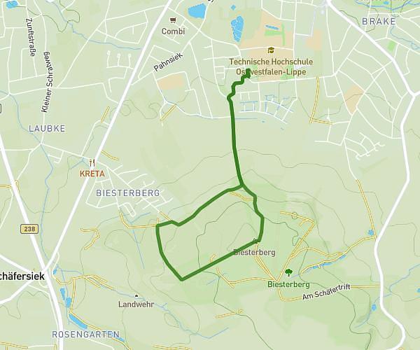
This running route covers 3.065mi starting from Bielefeld, North Rhine-Westphalia. The run is a loop trail and returns to the trailhead. This run is rated as easy, expect about 3s to complete it. The route has an elevation gain of 95ft and an elevation loss of 79ft.
Laufen 5
Route details
3678.27mph
Speed
1 kcal
Calories burned
Loop trail
Route type
344ft
Min altitude
440ft
Max altitude
Route profile
95ft
Elevation gain
79ft
Elevation loss
344ft
Min altitude
440ft
Max altitude
How to get there
Trailhead: Universitätsstraße 11, 33615 Bielefeld, Germany
GPS coordinates of the trailhead: 52.037205, 8.499432 / 52°2'13'' N, 8°29'57'' E