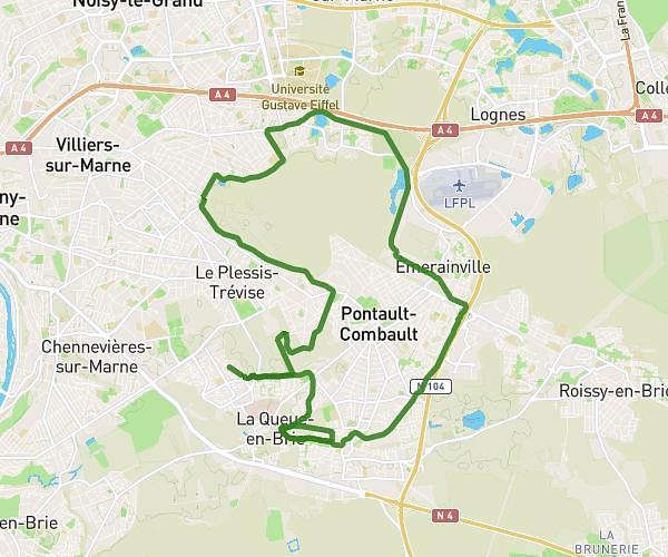
This running route covers 17.462mi starting from Bry-sur-Marne, Val-de-Marne. The run is a loop trail and returns to the trailhead. This run is rated as strenuous, expect about 2h48m to complete it. The route has an elevation gain of 13ft and an elevation loss of 16ft.
30km
Route details
6.21mph
Speed
1928 kcal
Calories burned
Loop trail
Route type
115ft
Min altitude
131ft
Max altitude
Route profile
13ft
Elevation gain
16ft
Elevation loss
115ft
Min altitude
131ft
Max altitude
How to get there
Trailhead: 8 Quai Victor Berrière, 94360 Bry-sur-Marne, France
GPS coordinates of the trailhead: 48.83416, 2.51819 / 48°50'2'' N, 2°31'5'' E