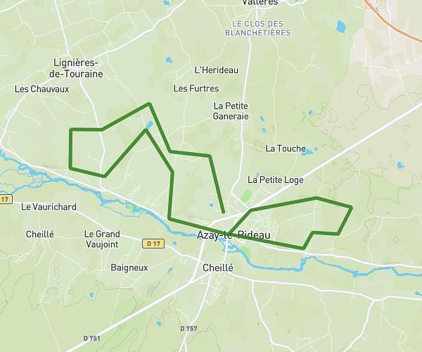
This running route covers 11.439mi starting from Langeais, Indre-et-Loire. The run does not return to the trailhead and ends near 66 Rue Nationale, 37190 Azay-le-Rideau, France. This run is rated as strenuous, expect about 2h3m to complete it. The route has an elevation gain of 840ft and an elevation loss of 863ft.
Frère
Route details
5.58mph
Speed
1406 kcal
Calories burned
Point to point
Route type
118ft
Min altitude
318ft
Max altitude
Route profile
840ft
Elevation gain
863ft
Elevation loss
118ft
Min altitude
318ft
Max altitude
How to get there
Trailhead: 1 Route Des Gaudinières, 37130 Langeais, France
GPS coordinates of the trailhead: 47.343846, 0.34014 / 47°20'37'' N, 0°20'24'' E