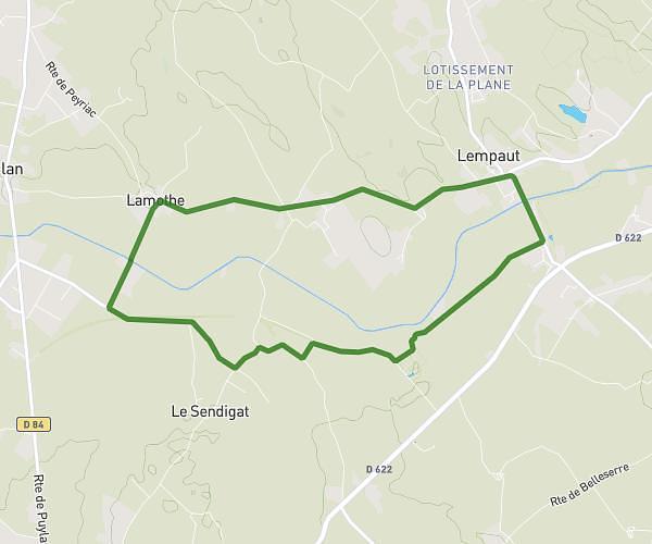
This running route covers 6.04mi starting from Graulhet, Tarn. The run is a loop trail and returns to the trailhead. This run is rated as moderate, expect about 1h3m to complete it. The route has an elevation gain of 187ft and an elevation loss of 161ft.
Nabeillou
Route details
5.75mph
Speed
720 kcal
Calories burned
Loop trail
Route type
591ft
Min altitude
778ft
Max altitude
Route profile
187ft
Elevation gain
161ft
Elevation loss
591ft
Min altitude
778ft
Max altitude
How to get there
Trailhead: 53 Avenue De Bérénice, 81300 Graulhet, France
GPS coordinates of the trailhead: 43.758274, 1.970026 / 43°45'29'' N, 1°58'12'' E