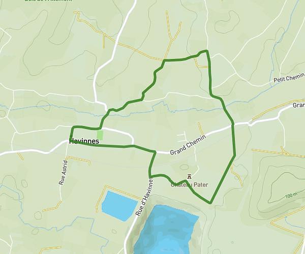
This hiking trail covers 3.08mi starting from Beloeil, Hainaut. The hike is a loop trail and returns to the trailhead. This hike is rated as easy, plan for about 1h2m to complete it. The route has an elevation gain of 148ft and an elevation loss of 148ft.
Marche gourmande Ecole Saint François Basècles
Route details
2.96mph
Speed
443 kcal
Calories burned
1.8%
Avg grade
Loop trail
Route type
118ft
Min altitude
174ft
Max altitude
Route profile
148ft
Elevation gain
148ft
Elevation loss
118ft
Min altitude
174ft
Max altitude
How to get there
Trailhead: Rue Grande 26, 7971 Beloeil, Hainaut, Belgium
GPS coordinates of the trailhead: 50.525964, 3.648191 / 50°31'33'' N, 3°38'53'' E