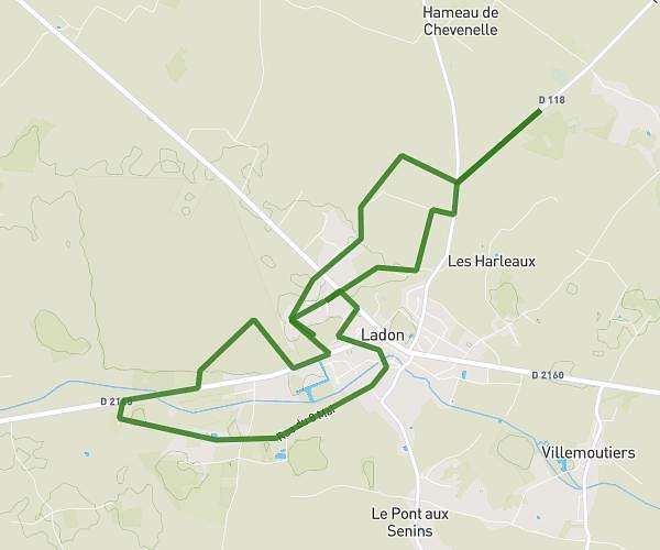
This hiking trail covers 6.45mi starting from Ouzouer-des-Champs, Loiret. The hike is a loop trail and returns to the trailhead. This hike is rated as easy, plan for about 2h7m to complete it. The route has an elevation gain of 95ft and an elevation loss of 92ft.
rando ferme 2026
Route details
3.04mph
Speed
894 kcal
Calories burned
0.5%
Avg grade
Loop trail
Route type
348ft
Min altitude
384ft
Max altitude
Route profile
95ft
Elevation gain
92ft
Elevation loss
348ft
Min altitude
384ft
Max altitude
How to get there
Trailhead: 170 Route De Gautereau, 45290 Ouzouer-des-Champs, France
GPS coordinates of the trailhead: 47.863837, 2.709109 / 47°51'49'' N, 2°42'32'' E