MapPlanner
10.455mi
Distance
1h3m
Duration
9.95mph
Speed
+75ft
Elevation gain
-75ft
Elevation loss
Easy
Level

10 mile loop

Route details

552 kcal
Calories burned
0.3%
Avg grade
Loop trail
Route type
735ft
Min altitude
794ft
Max altitude

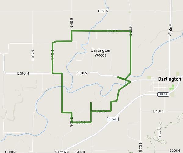
This cycling route covers 10.455mi starting from Crawfordsville, Indiana. The ride is a loop trail and returns to the trailhead. This route is rated as easy, plan for about 1h3m to complete it. The route has an elevation gain of 75ft and an elevation loss of 75ft.

Route profile

75ft
Elevation gain
75ft
Elevation loss
735ft
Min altitude
794ft
Max altitude

How to get there

Trailhead: 5597 East 500 North, Crawfordsville, Indiana 47933, United States

GPS coordinates of the trailhead: 40.11056, -86.7967 / 40°6'38'' N, 86°47'48'' W

Caution: May Cross Private Property

This route may pass through or near private property. Always respect posted signs, obtain permission where required, and follow local trespassing laws. MapPlanner does not guarantee public access along any route.

Safety Notice

Trail and road conditions may change without notice due to weather, construction, or other factors. Always verify current conditions before heading out. You are responsible for your own safety — follow local signage, obey traffic laws, and use your best judgment on the trail.