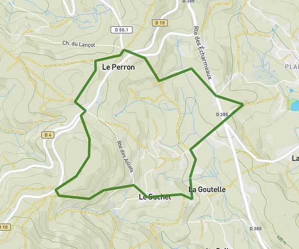
This running route covers 5.863mi starting from Dyo, Saône-et-Loire. The run is a loop trail and returns to the trailhead. This run is rated as moderate, expect about 57m to complete it. The route has an elevation gain of 1220ft and an elevation loss of 1201ft.
sortie bois dyo
Route details
6.17mph
Speed
652 kcal
Calories burned
Loop trail
Route type
997ft
Min altitude
1575ft
Max altitude
Route profile
1220ft
Elevation gain
1201ft
Elevation loss
997ft
Min altitude
1575ft
Max altitude
How to get there
Trailhead: Route De Mans, 71800 Dyo
GPS coordinates of the trailhead: 46.3658, 4.28196 / 46°21'56'' N, 4°16'55'' E