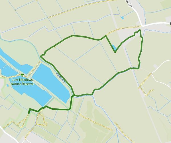
This walking route covers 3.383mi starting from Southport, England. The walk is a loop trail and returns to the trailhead. This walk is rated as moderate, plan for about 1h13m to complete it. The route has an elevation gain of 112ft and an elevation loss of 112ft.
Norwood meols
Route details
21:36/mi
Pace
298 kcal
Calories burned
Loop trail
Route type
10ft
Min altitude
30ft
Max altitude
Route profile
112ft
Elevation gain
112ft
Elevation loss
10ft
Min altitude
30ft
Max altitude
How to get there
Trailhead: 27 High Park Road, Southport, PR9 7QH, United Kingdom
GPS coordinates of the trailhead: 53.652658, -2.965329 / 53°39'9'' N, 2°57'55'' W