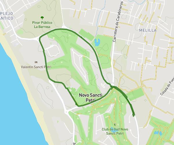
This hiking trail covers 2.897mi starting from Chiclana de la Frontera, Cádiz. The hike is a loop trail and returns to the trailhead. This hike is rated as easy, plan for about 40m to complete it. The route has an elevation gain of 118ft and an elevation loss of 128ft.
Día 12 aug
Route details
4.34mph
Speed
284 kcal
Calories burned
1.6%
Avg grade
Loop trail
Route type
52ft
Min altitude
118ft
Max altitude
Route profile
118ft
Elevation gain
128ft
Elevation loss
52ft
Min altitude
118ft
Max altitude
How to get there
Trailhead: Avenida Octavio Augusto 4b, 11139 Chiclana de la Frontera, Cádiz, Spain
GPS coordinates of the trailhead: 36.34904, -6.15318 / 36°20'56'' N, 6°9'11'' W