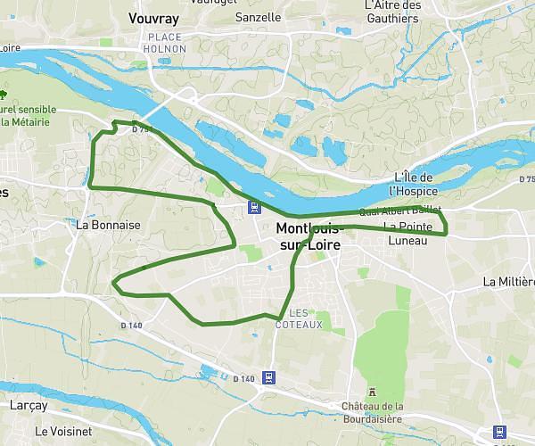
This running route covers 11.587mi starting from Montlouis-sur-Loire, Indre-et-Loire. The run does not return to the trailhead and ends near 9 Rue Ronsard, 37270 Montlouis-sur-Loire, France. This run is rated as strenuous, expect about 2h4m to complete it. The route has an elevation gain of 673ft and an elevation loss of 614ft.
Lea 07 juin 26
Route details
5.6mph
Speed
1418 kcal
Calories burned
Point to point
Route type
154ft
Min altitude
289ft
Max altitude
Route profile
673ft
Elevation gain
614ft
Elevation loss
154ft
Min altitude
289ft
Max altitude
How to get there
Trailhead: 30 Rue De Rochepinard, 37270 Montlouis-sur-Loire, France
GPS coordinates of the trailhead: 47.384509, 0.79851 / 47°23'4'' N, 0°47'54'' E