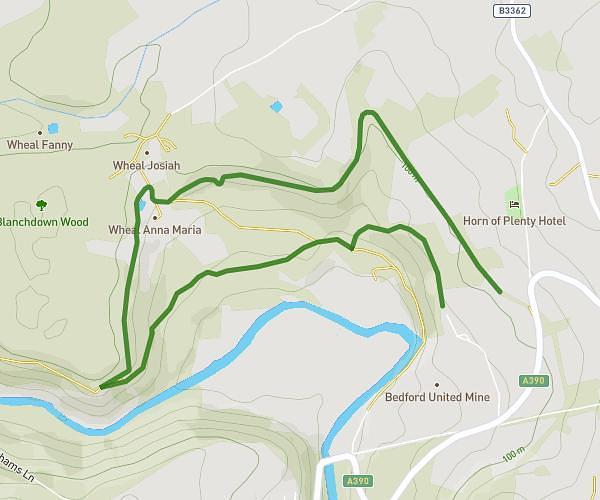
This running route covers 1.872mi starting from Plymouth, England. The run is a loop trail and returns to the trailhead. This run is rated as easy, expect about 20m to complete it. The route has an elevation gain of 236ft and an elevation loss of 243ft.
3parks
Route details
5.62mph
Speed
229 kcal
Calories burned
Loop trail
Route type
10ft
Min altitude
213ft
Max altitude
Route profile
236ft
Elevation gain
243ft
Elevation loss
10ft
Min altitude
213ft
Max altitude
How to get there
Trailhead: 2 Mount Gould Road, Plymouth, PL4 7PS, United Kingdom
GPS coordinates of the trailhead: 50.37824, -4.124393 / 50°22'41'' N, 4°7'27'' W