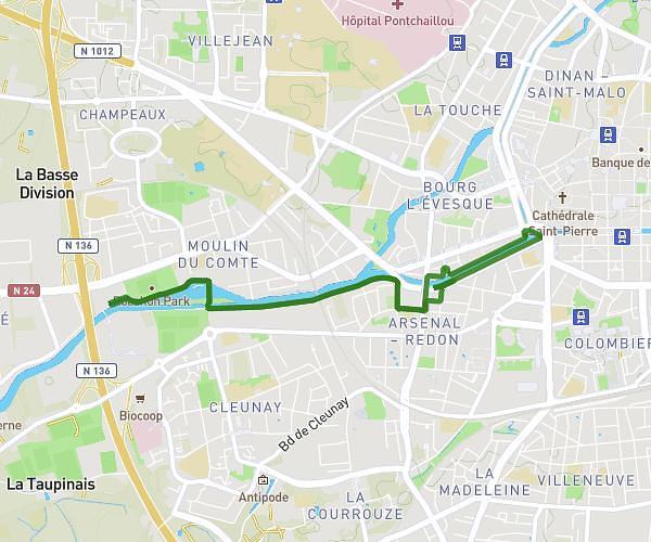
This running route covers 9.352mi starting from Rennes, Ille-et-Vilaine. The run is a loop trail and returns to the trailhead. This run is rated as hard, expect about 1h25m to complete it. The route has an elevation gain of 52ft and an elevation loss of 39ft.
rennes 15km
Route details
6.6mph
Speed
972 kcal
Calories burned
Loop trail
Route type
148ft
Min altitude
187ft
Max altitude
Route profile
52ft
Elevation gain
39ft
Elevation loss
148ft
Min altitude
187ft
Max altitude
How to get there
Trailhead: Rue Youenn Drezen, 35700 Rennes, France
GPS coordinates of the trailhead: 48.13188, -1.63542 / 48°7'54'' N, 1°38'7'' W