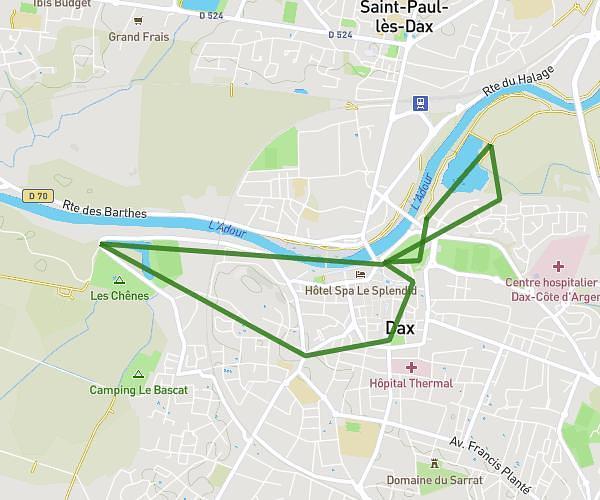
This hiking trail covers 4.913mi starting from Saint-Paul-lès-Dax, Landes. The hike is a loop trail and returns to the trailhead. This hike is rated as easy, plan for about 1h44m to complete it. The route has an elevation gain of 377ft and an elevation loss of 377ft.
jardin eglise lac
Route details
2.83mph
Speed
746 kcal
Calories burned
2.9%
Avg grade
Loop trail
Route type
20ft
Min altitude
115ft
Max altitude
Route profile
377ft
Elevation gain
377ft
Elevation loss
20ft
Min altitude
115ft
Max altitude
How to get there
Trailhead: 91 Rue Jean-Pierre Pénicaut, 40990 Saint-Paul-lès-Dax, France
GPS coordinates of the trailhead: 43.725836, -1.063875 / 43°43'33'' N, 1°3'49'' W