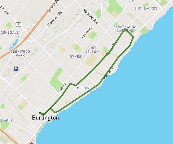
This running route covers 3.055mi starting from Burlington, Ontario. The run is a loop trail and returns to the trailhead. This run is rated as easy, expect about 32m46s to complete it. The route has an elevation gain of 177ft and an elevation loss of 180ft.
5km
Route details
5.59mph
Speed
375 kcal
Calories burned
Loop trail
Route type
262ft
Min altitude
299ft
Max altitude
Route profile
177ft
Elevation gain
180ft
Elevation loss
262ft
Min altitude
299ft
Max altitude
How to get there
Trailhead: 446 Brant Street, Burlington, Ontario L7R 2G4, Canada
GPS coordinates of the trailhead: 43.326409, -79.799191 / 43°19'35'' N, 79°47'57'' W