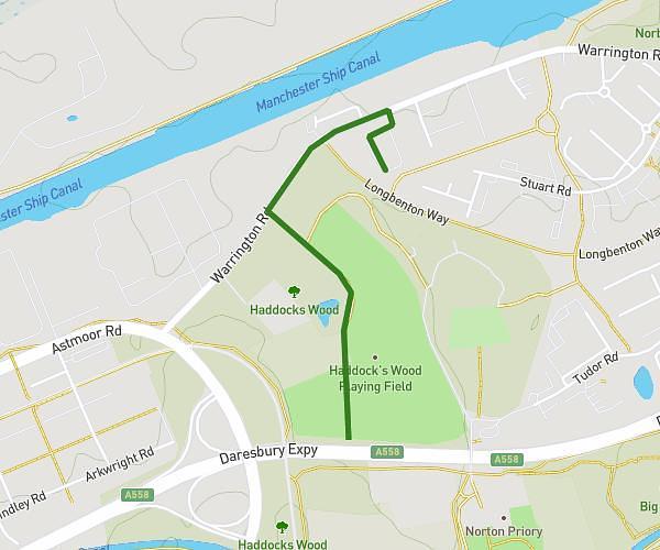
This walking route covers 2.684mi starting from Tarporley, England. The walk is a loop trail and returns to the trailhead. This walk is rated as moderate, plan for about 58m to complete it. The route has an elevation gain of 236ft and an elevation loss of 236ft.
Tarporley

Route details
21:36/mi
Pace
237 kcal
Calories burned
Loop trail
Route type
266ft
Min altitude
449ft
Max altitude
Route profile
236ft
Elevation gain
236ft
Elevation loss
266ft
Min altitude
449ft
Max altitude
How to get there
Trailhead: The Avenue, CW6 0BA Tarporley
GPS coordinates of the trailhead: 53.15549, -2.66651 / 53°9'19'' N, 2°39'59'' W