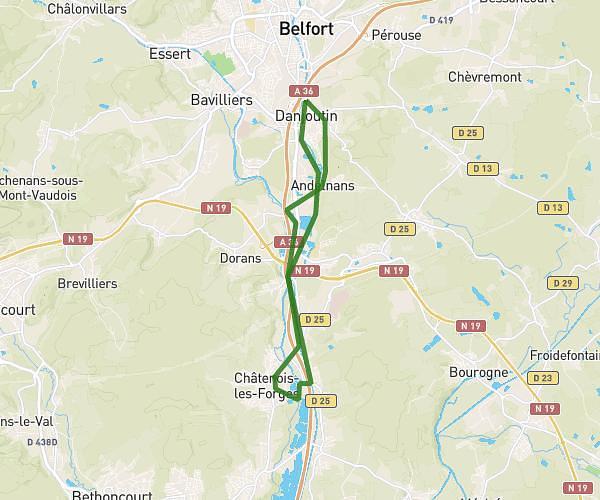
This running route covers 16.583mi starting from Voujeaucourt, Doubs. The run is a loop trail and returns to the trailhead. This run is rated as strenuous, expect about 5h56m to complete it. The route has an elevation gain of 138ft and an elevation loss of 174ft.
issans
Route details
2.8mph
Speed
4070 kcal
Calories burned
Loop trail
Route type
997ft
Min altitude
1158ft
Max altitude
Route profile
138ft
Elevation gain
174ft
Elevation loss
997ft
Min altitude
1158ft
Max altitude
How to get there
Trailhead: 15 Rue De La Blongeotte, 25420 Voujeaucourt, France
GPS coordinates of the trailhead: 47.4719, 6.77437 / 47°28'18'' N, 6°46'27'' E