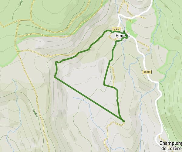
This running route covers 6.746mi starting from Florac Trois Rivières, Lozère. The run does not return to the trailhead and ends near 4 Chemin Des Faïsses, 48320 Ispagnac, France. This run is rated as moderate, expect about 1h12m to complete it. The route has an elevation gain of 1831ft and an elevation loss of 1942ft.
Ced
Route details
5.59mph
Speed
827 kcal
Calories burned
Point to point
Route type
1680ft
Min altitude
2172ft
Max altitude
Route profile
1831ft
Elevation gain
1942ft
Elevation loss
1680ft
Min altitude
2172ft
Max altitude
How to get there
Trailhead: N 106, 48400 Florac Trois Rivières, France
GPS coordinates of the trailhead: 44.324005, 3.598548 / 44°19'26'' N, 3°35'54'' E